01What You're Getting Into
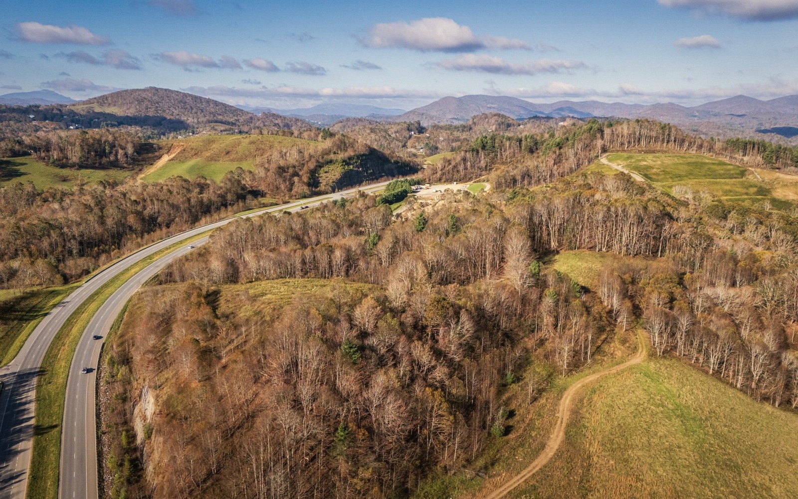
The Cherohala Skyway doesn't ease you in. Within a few miles of leaving Tellico Plains, the road is already climbing — past hardwood coves, through switchbacks that tighten with purpose, toward a ridgeline that eventually tops out above five thousand feet. By the time you reach the high overlooks straddling the Tennessee–North Carolina state line, you're looking out over an ocean of folded mountains that stretches in every direction without a rooftop or a cell tower in sight. It is, without much argument, one of the finest paved drives in the eastern United States.
The full route runs roughly forty miles from Tellico Plains, Tennessee, on the western end to Robbinsville, North Carolina, on the east. About twenty of those miles lie in Tennessee, passing through the Cherokee National Forest; the rest cross the Nantahala National Forest on the North Carolina side. The road is Tennessee Highway 165 on the Tennessee stretch and North Carolina Highway 143 beyond the line. Either way, locals just call it the Skyway.
A few practical notes before you go. The Skyway closes in winter when ice and snow make it impassable — typically sometime between late November and March, depending on the year, though closures can happen earlier or linger later. Gas up in Tellico Plains before you start; there are no fuel stops on the route itself. Cell service is thin to nonexistent for most of the drive. That's not a warning so much as a description: the Skyway is a place where the world quietly falls away.
02The Drive, West to East
Tellico Plains to the Tennessee overlooks. The town of Tellico Plains is your launching point — pick up coffee, snacks, anything you need. The road climbs almost immediately after you clear town, rising through second-growth forest and past the turnoff for Bald River Falls and the surrounding trail network before committing to the ridge. The grades here are serious — long, sustained climbs that motorcyclists worship and that will remind passenger-car drivers to check the temperature gauge. Take your time. The curves reward patience, and the forest around you shifts from oak-hickory mix in the lower elevations to northern hardwoods and eventually high-elevation red spruce as you gain altitude.
The state-line corridor is also where the road feels most otherworldly.
| When | Peak October | Late September | Early June |
|---|---|---|---|
| Colour | Full peak, valley to ridge | High country turning, valleys still green | Green, mountain laurel in bloom |
| Crowds | Heaviest; overlooks fill early | Light on weekdays | Nearly empty midweek |
| Weather | Crisp, cool at elevation | Mild, stable | Warm below, breezy up top |
The first major stop worth making is the Unicoi Crest area, where the road runs close to the ridge and the trees thin enough to hint at what's coming. Pull into any of the pullouts along this stretch and listen: on a weekday, you may hear nothing but wind and the occasional raven. The silence at elevation in the Cherokee National Forest is a specific, substantial thing.
The high country. The Skyway's best-known overlooks cluster around its highest elevations, and they deliver on every photograph you've ever seen. Santeetlah Overlook sits just across the state line on the North Carolina side and offers a panoramic view south and west across Lake Santeetlah and a hundred ridges beyond it — arrive early on a summer morning and you'll often catch low clouds pooled in the valleys below, burning off slowly in the sun. Hooper Bald, a short detour north of the main road in North Carolina, reaches 5,429 feet and sits in an open grassy bald — a rare high-meadow clearing that gives you 360-degree sky in every direction. It's a short walk from the parking area and worth every step.
The state-line corridor is also where the road feels most otherworldly. You're on the spine of the Unicoi Mountains, with Tennessee falling away to the northwest and North Carolina to the southeast, and the driving itself becomes almost meditative — long curves at altitude, the sky enormous above you, the engine note flattening out on the few level sections. This is the part of the Skyway people mean when they say it changes something in you.
North Carolina and the descent to Robbinsville. The eastern half of the Skyway through the Nantahala National Forest is less frequently discussed but no less beautiful. The road narrows in places, the forest closes in, and there are overlooks that many drivers blow past simply because they're focused on what they just saw. Don't. The descent toward Robbinsville passes through some genuinely wild country — deep hollows, seasonal waterfalls visible from the road after rain, stretches where the pavement is damp even in dry weather because the canopy never quite opens. Robbinsville itself is a small mountain town worth a stop for food, fuel, and a look around before you turn back.
03How to Do It Right
Timing matters more than people admit. Leaf season — mid-October into early November — is the obvious answer, and it's obvious for good reason: the Skyway in peak color is one of those experiences that adjusts your sense of what a landscape can do. But the crowds in October are real, and the overlooks fill up early on weekends. For a more solitary version of the same grandeur, try late September, when the high-elevation trees start to turn while the valleys are still green, or early June, when the mountain laurel blooms at elevation and the road is nearly empty on weekdays.
A short history
- Late 1960s onwardplanning and construction of the Skyway begins
- 1996Cherohala Skyway completed and opens to the public
| Stretch | Character | Don't miss |
|---|---|---|
| Tellico Plains → TN overlooks | Sustained climbs, tightening switchbacks | Unicoi Crest pullouts |
| The high country (state line) | Ridge-spine driving above 5,000 ft | Santeetlah Overlook · Hooper Bald |
| NC descent → Robbinsville | Narrow, wild, canopy closing in | Roadside falls after rain |
Summer weekends bring motorcyclists — the Skyway is legitimately famous in that community, and a convoy of bikes rolling through the overlooks is part of the culture now, not an intrusion on it. Weekday mornings in any season are consistently the quietest. The best-time-of-year-to-visit piece elsewhere in this guide covers the county's seasonal rhythms in more depth; the Skyway roughly follows the same logic.
Go slowly. The Skyway is fifty miles, and the temptation is to drive it in a single focused push. Resist. Build in at least three to four hours for the round trip from Tellico Plains — more if you plan to walk at Hooper Bald or eat in Robbinsville. The overlooks reward lingering, not checking off. Bring layers regardless of the season; temperature at the high points can be fifteen degrees cooler than Tellico Plains at the bottom, and the wind on the exposed ridges has real teeth.
One more thing. The Skyway was completed in 1996 after nearly thirty years of planning and construction — a road built to connect two remote mountain communities and, in doing so, to open some of the most spectacular terrain in the Southern Appalachians to anyone willing to make the drive. That the finished road is this good — this genuinely, unhurriedly beautiful — feels like something that should be said plainly. The Cherohala Skyway is worth your time.

Key places & names
Tellico Plains
small Tennessee town; western gateway to the Skyway
Robbinsville, NC
small mountain town; eastern terminus of the Skyway
Cherokee National Forest
federal forest covering the Tennessee portion of the route
Nantahala National Forest
federal forest covering the North Carolina portion
Hooper Bald
5,429-ft grassy summit bald just off the Skyway in NC
Santeetlah Overlook
panoramic viewpoint near the NC state line
Unicoi Mountains
the range the Skyway follows along the TN/NC border
Lake Santeetlah
NC reservoir visible from Santeetlah Overlook